All posts by reaglin

Sea to Sea AR (2017) – Section 09

Summary

Teams will be biking into the Holder Mine Campground in the Citrus tract of the Withlacoochee State Forest. At Holder Mine they will compete in an orienteering challenge. Four orienteering (true Orienteering) courses will be available – the same courses run earlier that day by the Suncoast Orienteering. Each course is worth one checkpoints – and teams must compete as a team completing the course in order and checking in between each course.

Once complete the teams will be held for a mass restart at 5 AM where they will make the final push on bike and paddle to the finish line.

Map of Bike Leg to West Coast
Map of Final Paddle 

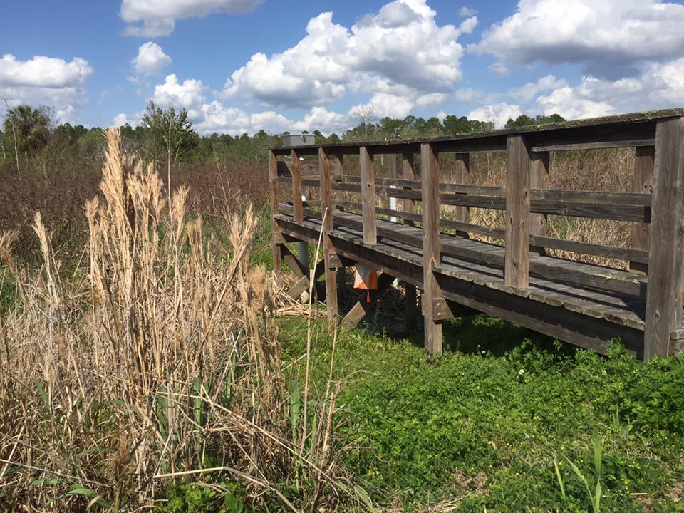
TA8 – Holder Mine Campground – Citrus Tract

(Dark Zone)

Holder Mine campground will serve as the dark zone. Bins will be availab. Teams will be held here until 5 AM on Sunday morning. All teams arriving at Holder Mine camp before 5 AM will restart at 5 AM.

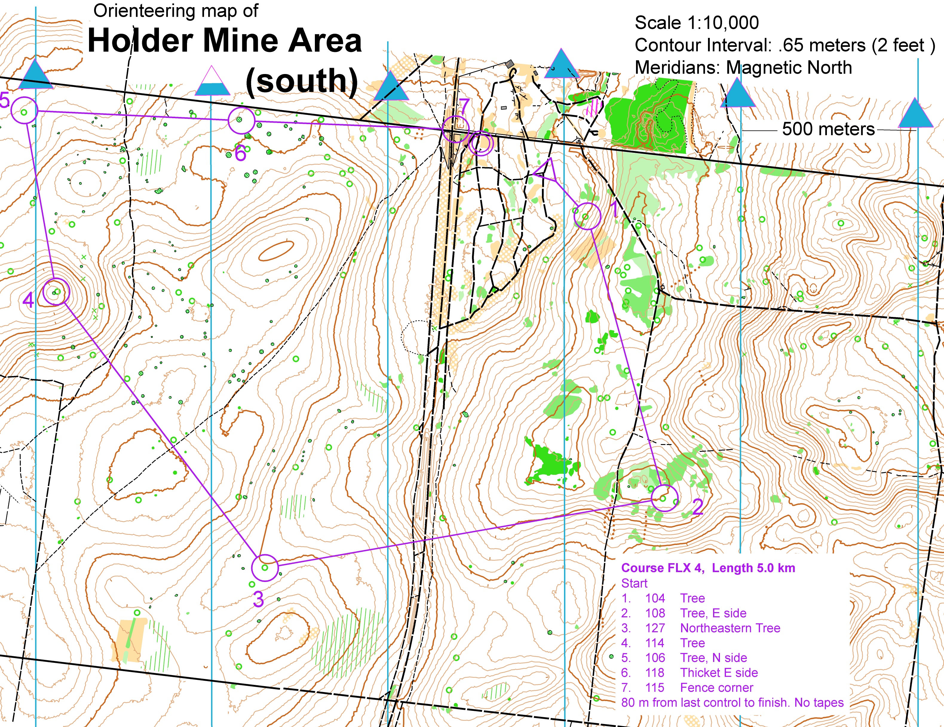
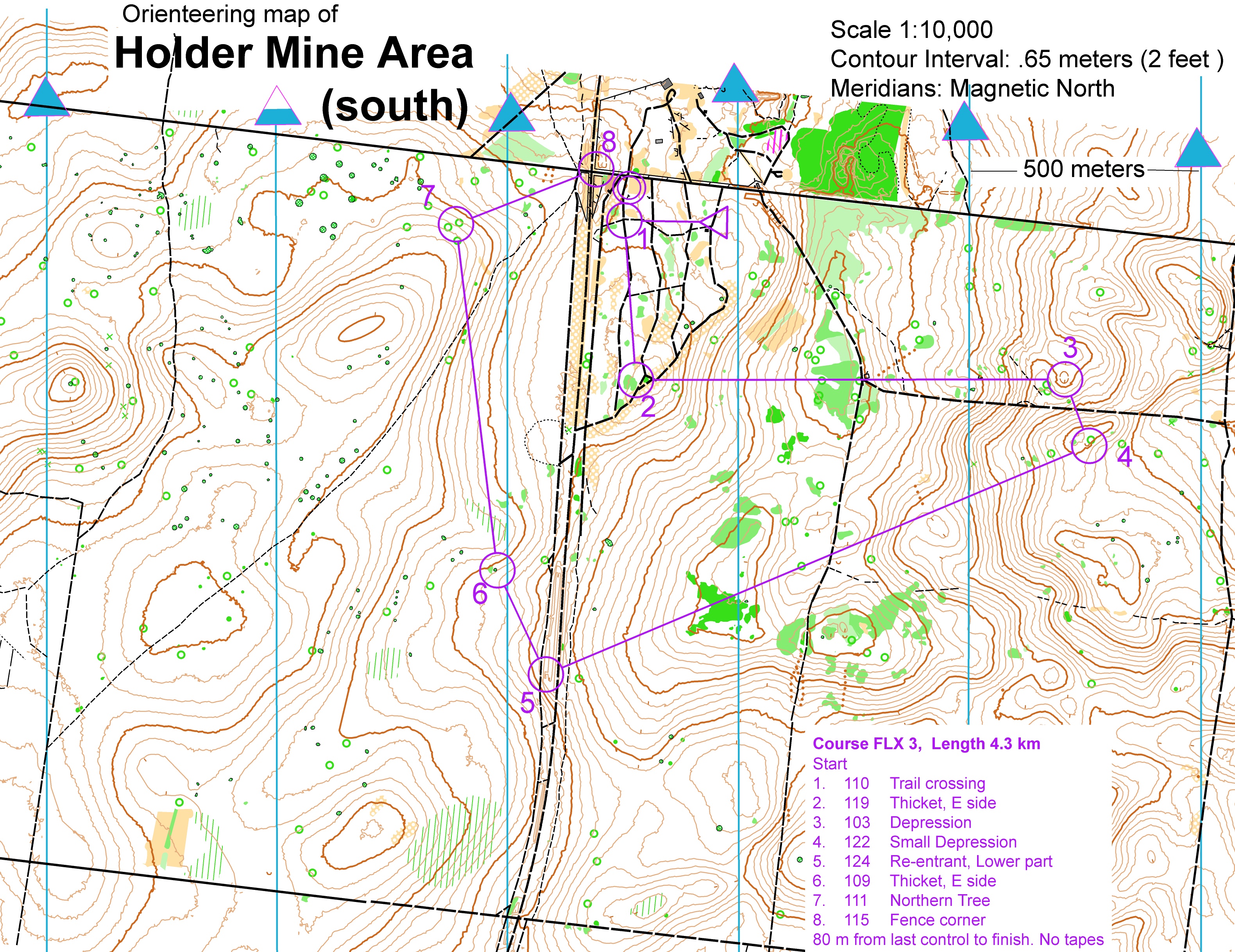
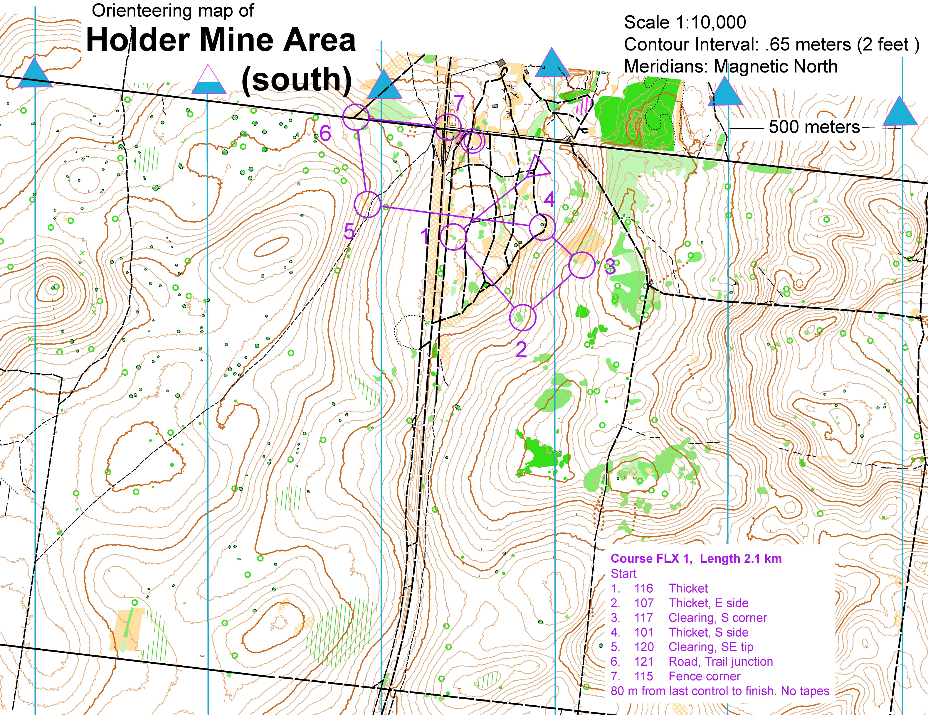
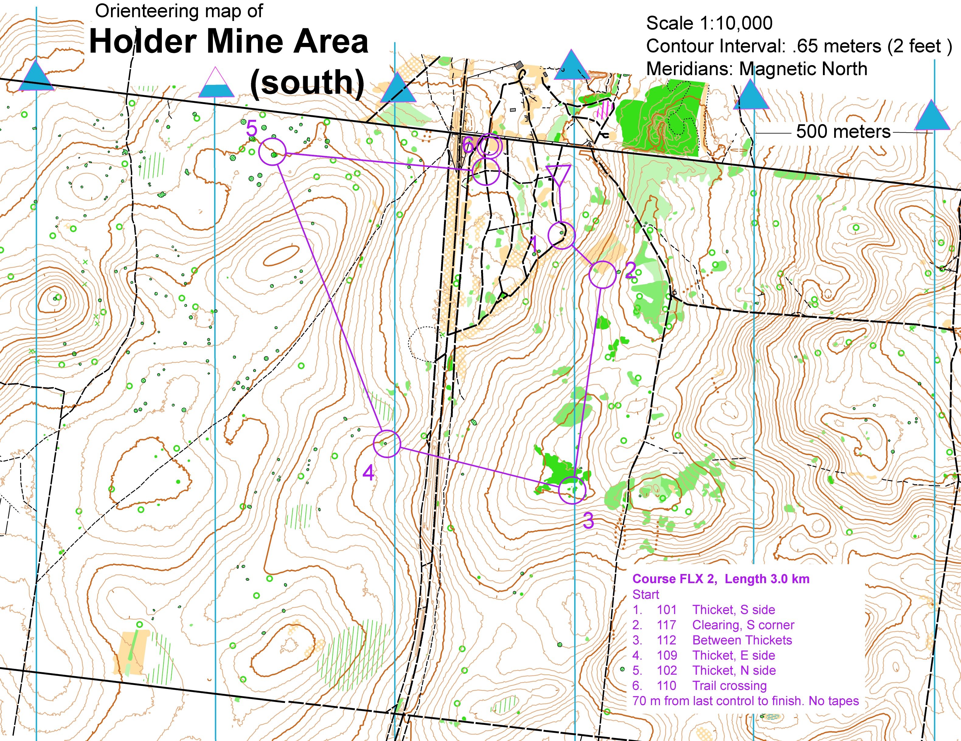
Segment 13 – Citrus Orienteering Challenge

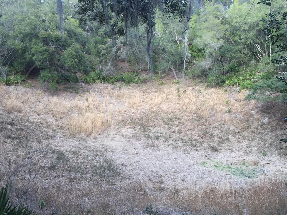
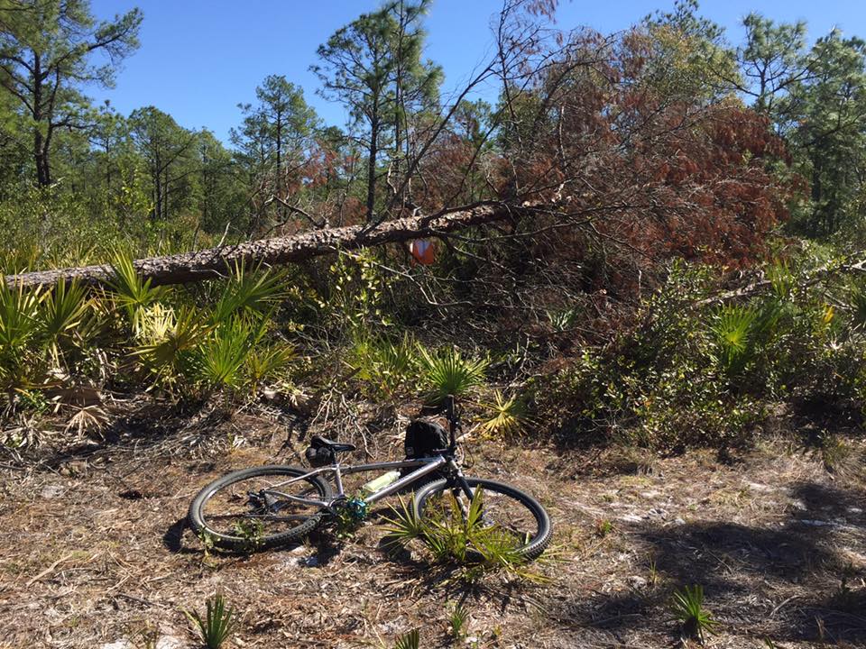
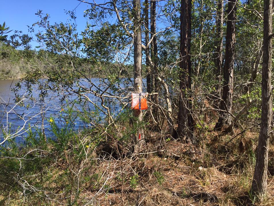
At TA8 teams will have the option of completing the Orienteering Challenge prior to entering the Dark Zone.There will be four (4) orienteering courses starting from Holder Mine TA that range in difficulty from Orange to Blue. Full completion of each course will be worth one checkpoint. You will be using a SportIdent e-punch and Orienteering Maps for each course. Once a team has completed the Orienteering and and have entered the dark zone the race time will stop.

CP47 (2.3 km) – Orange Course CP48 (3.2 km) – Green Course
CP49 (4.3 km)- Red Course CP50 (5.3 km) – Blue Course

Segment 14 – Bike to West Coast

(28 miles, 3-4.5 hours)

This final bike leg after leaving Citrus will take you all the way west to the  Fort Island TA. On the way ,you will drop bikes at the manned Waypoint along Fort Island Trail and trek to CP53 and back. Portions of this leg require travel on paved roads, always travel single file and use caution when riding with traffic.

Map Set – Bike V

CP51 – Big Oak near Intersection CP52 (Photo) Two Deuces Restaurant
CP53 – End of Trail

TA9 – Fort Island Beach and Boat Launch

This is your final transition area in the Florida Sea to Sea. You will have access to your paddle bags here, but not your bins.

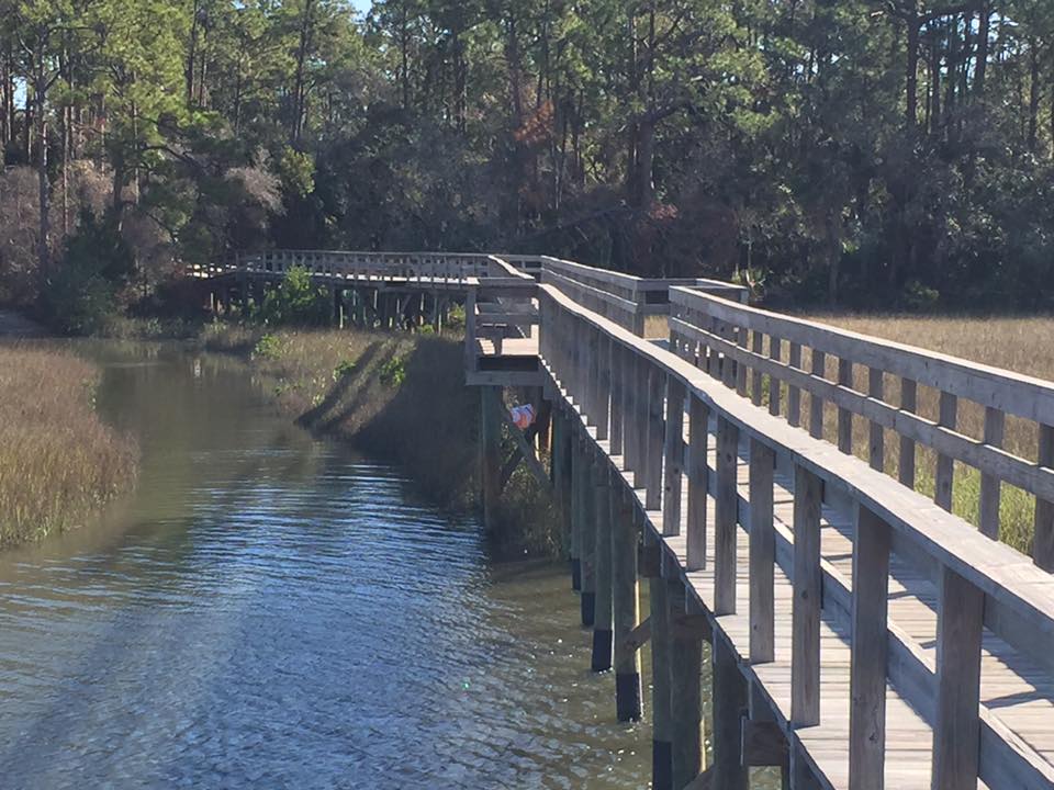
Segment 15 – West Coast Paddle

(8  miles, 2-3 hours)

This incredible paddle along the Crystal River will bring you to the finish line. Enjoy.

Map Set – Boat IV

CP54 – Edge of River

Final Courses.FLX 4   Final Courses.FLX 3      Final Courses.FLX 1  Final Courses.FLX 2


Sea to Sea AR (2017) – Section 08

Summary

At this point in the race teams are sleep deprived, tired, and hungry. Santos Rec area will allow for some rest and refuel before the push to the dark zone. This is a bike leg starting with some serious single track and eventually becoming a rail-trail/road ride. Recommended route is along the Withlacoochee trail which will allow teams respite from traffic and the quickest route to the next TA

Map of Full Bike Leg
Map of Santos Single track section 

TA7 – Santos Historic Recreation Area

(Saturday 4 AM – 10 AM)

The Santos Historic Recreation area is on the east side of 441, you will have access to gear bins at this TA. The Santos Trailhead and Santos bike shop are west of 441 approximately ¼ mile from the TA.

Segment 12 – Santos to Citrus Bike

( 50 miles, 7-9 hours )

This next segments starts out with the classic Santos Epic Mountain Bike ride. For this section you should follow the signs for the IMBA Epic Mountain bike ride west. The full epic ride is a loop, you will exit the epic ride at Pruitt Trailhead. Controls will be along each of the named trails below and will be readily visible from the bike trail. The trails that make up the epic heading west are;

Pine Tree – Twister – Dog Bone – Spider Kingdom – Land Bridge –  Christmas – Nayl’s Way – Ern ‘N Bern – Tricycle Trail – Limerock Road – Pruitt Trailhead

At Pruitt Trailhead you will need to head north to 484 and then west to the Dunnellon Trailhead to enter the Dunnellon Trail and across the Dunnellon Trail  Bridge. Follow the trail until the west terminus and then head west to pick up the Withlacoochee Trail. The Withlacoochee  Trail is your best route south towards the entrance to the Citrus Tract of the Withlacoochee State Forest. If you get to the Inverness trailhead you will want to head west towards TA8.

Map Set – Bike III

CP41 – Along Twister Trail CP42 – Bench at intersection of Spider Kingdom (N) & Spider Kingdom (S)
CP43 – Along Christmas Trail (west of vegetation boundary) CP44A – Along Nayls Trail (N)

CP44B- Along Err”N Bern Trail

CP45 – Along Tricycle Trail (near intersection of Razorback Ridge trail) CP46 (Photo) – Dunnellon Trail Bridge

You must collect CP44A & CP44B to receive credit for CP44

Sea to Sea AR (2017) – Section 07

Summary

Once teams get to Road 314 they will rack the boats and carry their paddle gear 1 1/2 miles to Marshall Swamp Trailhead. After recharging here they will head out on foot along the Florida Trail to Santos Recreation Area

Map of Trek from Marshall Swamp TH to Santos

TA6 – Marshall Swamp Trailhead

(Saturday 2 AM – 6 AM)

Marshall Swamp trailhead will have access to gear bins. Bathroom facilities are available at the trailhead.

Segment 11 – Marshall Swamp Trek

(9 miles, 3-5 hours)

Team will now follow the Florida Trail to the Santos Historic Recreation Area collecting CP’s 39 & 40 along the way. The first section of this trek will take teams through the Marshall Swamp which during wet weather can be very wet.

Map Set – Foot V

CP39 – Picnic Table CP40-Large Oaks along FL Trail

Sea to Sea AR (2017) – Section 06

Summary

Teams will arrive at Sunnyhill Conservation area on bike. Once here they will get their first real chance to do some foot orienteering. 8 checkpoints are available for teams in Sunnyhill after which they will head out on boat on the Oklawaha River

Map of Sunnyhill O Area (they will be plotting their points)
Map of Oklawaha Paddle

TA5 – Sunnyhill Conservation Area

(Friday 1 PM – 10 PM)

Teams will have access to bins and paddle bags at Sunnyhill. Food may be provided at this TA

Segment 9 – Sunnyhill Orienteering

(5 hours for all checkpoints)

Teams will now have the option of collecting checkpoints with the optional Sunnyhill Orienteering course. This is a Rogaine course where teams must complete the course before 9 PM Friday. Teams will receive the UTM Coordinates and descriptions of the 9 Checkpoints when they check in at Sunnyhill.

Map Set Foot – IV

CP28 – CP36 UTM coordinates and descriptions will be given to teams at Sunnyhill

CP28A

Segment 10 – Oklawaha Paddle

( 18 miles, 5-7 hours)

You will now paddle north on the dug channel that is the southern end of the Oklawaha river towards Moss Bluff Dam collecting CP37 along the way. When you arrive at Moss Bluff Dam you must exit the river on the EAST (right) side and Portage your canoes around the dam.

At the completion of the paddle at SR 314 Bridge take out on the EAST (right) side of the river and south of the bridge. There is a short portage to the road,  you will rack boats and carry paddle gear approximately one and a half  (1.5) miles to the Marshall Swamp TA.

Map Set – Boat III

CP37 – Staff Gage CP38 – Boat Ramp at Moss Bluff portage


UTM Coordinates for Racers


Sea to Sea AR (2017) – Section 05

Summary

At Clearwater Lake Camp teams will transition back to bike. Teams will have the option of completing the 22 mile Paisley single track bike loop for 2 checkpoints before heading out towards Sunnyhill – a long bike through the Ocala National Forest.

Map of Section 5

TA4 – Clearwater Lake Campground

(Friday 4AM – 1PM)

Just North of the entrance to the Ocala bike loop and Florida Trail trailhead  parking area you will reach the Clearwater Lake Campground TA. At the TA you will have access to your gear bins, restroom facilities, and even showers.

Segment 7 – Ocala Paisley Woods Bike Loop

(22 miles, 2-3 hours)

Teams arriving before 8 AM Friday will have the option of completing the Paisley Woods bike loop. The full loop is 22 miles and is worth 2 checkpoints. Teams arriving before 9 AM Friday will have the option of completing the short loop CP19 only for 1 checkpoint. Teams that choose to complete the loop will need to take a camera or cell phone capable of pictures.  To start the loop head back southeast east on the paved road to the trailhead parking area. Follow the blazes to complete the loop.  Please complete the loop in a clockwise direction to avoid oncoming bike traffic. Check out of TA4 when leaving on the loop and check back in when returning to receive credit for checkpoints. Teams arriving after 9AM or teams choosing not to do the bonus CP’s proceed to segment 7

Bonus bike loop checkpoints

Map Set – Bike II

CP19 (Photo) – Bike loop trail cutoff sign CP20 (Photo) – Bike loop North Kiosk

Note: The Yellow Blazed bike trail is fastest method of completing the loop.

Segment 8 – Ocala National Forest Bike

( 30 miles ,4-6 hours)

You will now complete a bike ride across the southern part of the Ocala National Forest heading towards Sunnyhill Conservation area TA collecting CP’s 21-27 along the way. Select checkpoints in this ride wisely, many of the roads and trails along this segment can be sandy (Florida’s version of hills) or muddy.

Map Set – Bike II

CP21 – Sinkhole CP22 – Lake Dorr
CP23 – Green’s Waterhole CP24 – Oak in Grassy Field
CP25 – In Clay Pit near fence corner CP26 – Horse Trail West Side of Pond
CP27 – Observation Tower


Sea to Sea AR (2017) – Section 04

Summary 

Once teams arrive in River Forest Park on the east edge of the Ocala National Forest they will have a chance to fuel up for the long trek leg ahead of them. This trek takes them through the St. Francis trail eventually reaching the Florida National Scenic Trail and ending up near Paisley are Clearwater Campground

Maps of Section 4

TA3 – Ocala River Forest Camp

(9 PM – 6 AM )

River forest camp is located on the west side of the St. Johns River bridge. Bathroom facilities and bins will be available at the TA

Segment 6 – St. Francis to Paisley Trek

( 19 miles, 6 -7.5 hours )

This incredible trek will take teams from Ocala River forest TA to the Clearwater Lake TA collecting CP’s 15 – 18 along the way. The  start is on the St. Francis trail, teams will travel one side of this 8 mile loop. Please use caution on the many boardwalks as they are very slick when wet.

When approaching CP16 you will need to go North and around on the forest roads to avoid the private property.

After CP18 we recommend you follow Orange Blazed Florida Trail to Clearwater Lake Trailhead (Bike Waypoint). Trail is not exactly as mapped, but Orange blazed trail will get you to the paved trailhead.

Map Set – Foot III

CP15 – St, Francis Dead River CP16 – South Edge of Dry Lake

CP16

CP17 – Tracey Creek North of Road

CP17

CP18 – Pine tree on point at Duck Pond

CP18

Sea to Sea AR (2017) – Section 03

Summary

Teams will arrive at Beresford Park in Deland and drop their bikes. They will receive UTM coordinates for 2 foot CP’s that they will be able to visit as they head on foot to French Landing and the second paddle leg – also part of this segment. The paddle leg will take them around the west side of Hontoon Island via Snake Creek to Dead River and then to the St. Johns River heading past the SR 40 bridge and Ocala Riverside Park.

Maps of Section 3

TA2 – Lake Beresford Park

(Thursday 2 PM – 5 PM)

There will be NO Bin access at  TA2 Lake Beresford Park. This park has bathrooms and water will be available. All teams must leave Lake Beresford Park before 5 PM. Teams arriving after 4:30 PM will be rerouted on bike directly to the boats at French Landing.

Segment 4 – Lake Beresford Park to French Landing

(4 miles, 1-2 hours)

Teams arriving at Lake Beresford Park prior to 4:30 PM will be given the UTM Coordinates and descriptions of CP11 and CP12.

Teams will trek approximately 4 miles from Lake Beresford Park to the boats at French Landing collecting CP’s 11 & 12 along the way. Paddle bags will be available at the boat launch. Bins will not be available at French Landing.

Maps Set – Foot II & Boat II

CP11 – UTM Coordinates at Beresford CP12 – UTM Coordinates at Beresford

Segment 5 – Snake Creek Paddle

(11 miles,  3-4 hours)

Teams will now paddle through incredible Snake Creek and around Hontoon Island to the Ocala River Forest Camp TA collecting CP’s 13 & 14 along this amazing night paddle. CP14 is accessible via the Waypoint on the West Side of Hontoon Island and following the blazed trail to the mound.

Map Set – Foot II & Boat II

CP13 – Snake Creek Entrance CP14 – Indian Mound on Hontoon Island (Photo)

Sea to Sea AR (2017) – Section 02

Summary

Teams will arrive off the paddle around Thursday noon and will get a chance to do the individual time trial along the single track trails of Spruce Creek Preserve. Teams will complete the marked Spruce Creek loop individually before regrouping and heading out on bike leg 1 taking them the Long Leaf Pine Preserve, through Cassadaga to Deland and eventually Lake Beresford Park and TA2.

Maps of Section 2 – Time Trial
Maps of Section 2 – Bike to TA2

TA1 Spruce Creek/Doris Leeper Park

(Thursday 12PM – 2 PM)

At TA1 you will transition from paddle to bike. You will need to portage canoes from the canoe launch to the boat drop and then proceed with paddle gear to TA1 (as mapped). Follow instructions at the boat drop as to where to put gear, middle seats, and boats.

Segment 3 – East Coast Bike

(48 miles including time trial, 4-6 hrs)

This leg starts with an Individual Time Trial which will  start and end at CP5.  Team members will compete individually in a bike time trial along the spruce creek bike trail network. There is no mandatory gear for the time trial (other than bike and helmet) This short, fun loop will be individually timed and will earn each team a CP. All members of the team must complete the time trial for the team to receive credit for the CP. The trails are one way so please follow the correct directional arrows.  Awards will be given to the male and female  winners of the time trial.

Once you complete the time trial, you will exit the TA using the same trail network as the time trial, please use caution and be courteous to the teams doing the time trial, again follow the directional arrows. Proceed towards Lake Beresford Park (TA2) in West Deland collecting CP’s 6-10 along the way.nts may come behind you, please allow them to pass. The trails are one way so please follow the correct directional arrows. Portions of this leg require travel on paved roads, always travel single file and use caution when riding with traffic.

Map Set – Bike I

CP5 – Individual Time Trial


CP6 (Photo) Sopotnick’s Cabbage Patch

Gempsots Photos

CP7 – Hurricane Pine in Long Leaf

CP7

CP8 – Sw Tip of Lake

CP8

CP9 – Webster’s Garden (Cassadaga)


CP10 – JC Bicycle Shop

Link


Sea to Sea AR (2017) – Section 01

Summary

After riding the bus across the state and getting a last minute chance to work through the course, teams should arrive in Ponce Inlet around 9 AM. From here they will head past the lighthouse and to the Jetty – and then North up the beach. Spectators should be get to see some awesome pictures of the teams as they complete the photo scavenger hunt in Ponce Preserve before heading for Ponce Inlet Marina and the canoes. They will then paddle through the Spruce Creek Preserve towards Doris Leeper Park, their bins and the next bike leg.

Maps of Section 1

Start – Ponce Inlet Run to Paddle

(Thursday 9 AM)

Segment 1- Ponce Inlet Photo Scavenger Hunt

(3 miles, 1 – 1.5  hrs)

You will be dropped off at the Ponce Inlet Lighthouse Point Park, Bins will not be available at the start location, you will have access your bins at TA1, after the paddle . You will need a working camera to complete the CP-2 photo scavenger hunt. Successfully completing the scavenger hunt will be worth one CP.

Start Instructions

After CP-1 proceed on foot to Ponce Inlet Preserve (CP-2). You may enter the Ponce Inlet Preserve from the beach. You will need to take 5 photographs of members of your team at the locations located within the preserve. You should display at least one team member & your team number in all photos. You can find the locations by following the signs along the trail network in the preserve. You will need to cross Peninsula Drive and Atlantic Ave to get all 5 photos, please use caution while crossing or traveling on the roads.

Photo Locations:

  1. At the river pavilion at the far west end of the boardwalk.
  2. Between the 2 bears at the main Ponce Inlet Preserve entrance
  3. In front of the Green Mound Oak
  4. At the Overlook in the main preserve
  5. At the beach side pavilion east of  Atlantic Ave

Upload the photos to gemspots.com/flx or show them to Race Staff at the boat launch for credit.

After taking the photos, proceed to the beach and head south towards Inlet Harbor Marina where you will have access to your  Paddle Bags.  Bins will not be available until you reach the end of the paddle at TA1.

Map Set – Foot I & Boat I

CP1 – Record year on benchmark at end of jetty CP2 – Complete photo scavenger Hunt

Gemspots Photos

Segment 2 – Spruce Creek Paddle

(8.5 miles,  2.5 hrs)

This short paddle will take you through the intracoastal waterway to through the Spruce Creek preserve. This is an incredible saltwater estuaries with plenty of wildlife and should be quite active during this morning paddle. Both checkpoints along this route will be traditional control flags.

Map Set  – Foot I & Boat I

CP3 – Entrance of Murray Creek CP4 – Spruce Creek Park Pavilion

CP3